Showing posts with label freefall. Show all posts

Thursday, January 7, 2021

Dehydrated Lasagne on the Trail

What to eat on the trail? How many of us have asked that question before heading out on a multi-day trip or even a thru-hike. I hiked the Appalachian Trail on Ramen, Mac N' Cheese, Oatmeal, and Snickers bars. Yeah, it got old. By the time I hiked the Pacific Crest Trail in 2003, I started adding dehydrated vegetables to my meals, giving them a bit more nutritional content and a more complex texture. When I hiked the Continental Divide Trial in 2009, I pretty much got things dialed in, eating a dehydrated meal two out of every three nights. One of the best meals I had on trail was homemade lasagna.

Leftover Lasagna and Dehydrator
Lasagna goes in there!


Dehydrated Lasagna
Dehydrated Lasagna
Here's how I did it. Cook any lasagne recipe that you have (sometimes the boxes have a recipe on the side), and after it is finished, let it cool it down. Might as well have a slice to eat while it is warm - nothing like a freshly made lasagna. Anyway, put it in the refrigerator, and let the entire lasagna congeal. Slice it in 3/4 - 1" slices after it is cold, and then put it in a food dehydrator. The dehydration process will take about 18-20 hours, which is longer than other dehydrating other foods like refried beans or even bananas.


Now comes time to package your lasagna. I have one of those Seal-A-Meal devices, which I bought at an Albertson's in San Francisco. It works, but they are noisy, and foods that get jaggedy and sharp can puncture the plastic wrap. Yes, when dehydrating lasagne, it is important to package it carefully, so that the dried pasta does not puncture the seal. I've found that it is sometimes best to wrap the lasagne in a layer of regular Saran Wrap to soften the jagged edges from puncturing the seal-a-meal packaging. My friend, Stormy, told me that she and her partner ran their dehydrated meals through a food processor and blender to prevent punctures in their seal-a-meal wrappings. She ate what she described as "power mush,' saying that they had all the flavor, but the consistency of mush.


On trail, it is a good idea to pull out the lasagne at the beginning of the day, and add just a slight amount of water. Allow the lasagne to absorb the water, and kind of let it stew on the outside of your pack all day. Be sure the lasagna is not going to leak out its water, and furthermore be careful with how it is situated in your pack - trust me, you don't want lasagna water running all over your pack!


When it is time to cook, add more water, but not a lot more. I know that's vague, but I don't bring measuring cups with me in the backcountry. Still, rehydrating your lasagna is just going to best left to your own judgment. I personally don't like to eat my lasagna as a stew, so I carefully monitor how much water I put in my cook pot. Only a little bit of fuel (good reason why it is ultralight!) should be used to heat up the lasagna. Stir briskly in the pot, so it does not burn the bottom of your pot, add a bit more water if needed, and enjoy!


Lasagna in the Cook Pot
Cooking Lasagna

The lasagna will not have the exact same consistency as if you pulled it out of the oven, but it's close. Just a reminder, it's freaking lasagne on the trail! Enjoy it while everyone else eats their Knorr with tuna or an over-priced Mountain House meal in a heavy-duty plastic packaging. Treat yourself well out there. Eat right, and happy hiking!


Freefall Enjoying Lasagna
Happy Hiker Eating Lasagna


Sunday, July 12, 2020

Herman Creek - Nike Terra Kiger Review Part 1

Several years ago, I hiked a loop with my buddy Allgood, taking the PCT out of Cascade Locks up to Wahtum Lake, and back down the Herman Creek Trail. It's a great trip! One of my favorite memories from that trip was camping overnight at Cedar Swamp on the Herman Creek Trail. I got out of Portland this past weekend to get back up there to re-visit this quiet, beautiful, dense cedar grove, and escape the hustle and bustle of my urbane existence.

Herman Creek Trail Sign

Herman Creek Trail Sign


I also just got a pair of Nike Terra Kiger trail runners, and I promised my client, who works for Nike, that I'd give them a thorough review, to see how they perform as a shoe for the long distance hiker. I've tested and reviewed gear before for Mountain Hardwear and Salomon, and am always interested to see what other stuff is out there. I still trend towards wearing LaSportiva Wildcats (love the shoe!), but I feel the need to expand my awareness to what else is out there. I've not owned a pair of Nikes in maybe 27-years, so it's been a long time since the swoosh was spotted on my feet.


For those who have not been up the Herman Creek Trail #406 from the trailhead parking lot, all I can say is get ready to get the heart pumping. The climb up is a steady, monotonic ascent through dense forest, some of which burned up in September of 2017. The burning and scarring on the trees is quite noticeable on this hike, and apparently worse on the Nick Eaton Trail, and signs indicate that this trail is damaged and difficult to hike. Still, it seems like the fire in 2017 might have made this stretch of forest heartier and healthier in the long run, since it consumed a lot of the thick understory. That said, I am no forest expert!

burned trees

Large Burned Tree

An old burned tree


Back to the climbing. Yes, this trail will get the legs burning if you push it, and I did. I brought my dog, Lucy, with me on this hike, and I was trying to keep pace with her, since she was on leash ahead of me. The climb meandered in and out of gullies, and thankfully crossed many small flowing streams or rills, where I (or my dog) could catch my breath and get a drink water. 

Dog standing in a stream

Lucy cools off and drinks from this stream


As I continued my ascent, I noticed how comfortable my feet were in these Nikes. What's more is that I noticed how well they gripped the trail's tread. The Terra Kigers do not have the traditional black rubber sole with a space alien pattern of yellow or red coloring the bottoms. Instead, the soles are red and white, with some good knobby lugs on the bottoms, which provide an excellent grip on dirt, rocks (wet and dry), and roots. Nike says that these shoes feature Multi-Surface Traction, boasting "Multidirectional traction lugs in the forefoot and heel (that are) are made from high-abrasion rubber for enhanced grip on descents and ascents. A rubber pod at the midfoot helps deliver wet-surface traction." I never once felt the soles slide out from underneath my feet. These are good shoes. 

Nike Air Zoom Terra Kiger 6 Trail Running Shoes

Nike Air Zoom Terra Kiger 6 Trail Runners

After 7-miles of charging uphill, I made it to my destination: Cedar Swamp. There are plenty of cedars up here, and they are huge trees. Some trees have seen the axe (or chainsaw), but for the most part, this grove of trees has been spared large swaths of cutting. The terrain is not really that swampy, but a nice flowing stream provides water through the flat areas best for camping. Still there were bugs up here! Tired from the couple hours of hiking, I pitched my tent, made dinner, and snuggled with my dog for the night.

Dog and massive cedar tree

Lucy stands in front of a huge cedar tree


After all the ascending the day before, I could look forward to how well the shoes were going to hold up on the now steady descent. Again, I was very impressed with their traction. My feet also honed in on the cushioned ride I was experiencing on the trail. I was not feeling any rocks or nubs on the tread. If anything bothered me about the shoes it was that my toes felt more confined than they did the day before, but I chalk that up to feet swelling from the 7+miles of hiking I did a day earlier. As a side note, the shoes I got are a full size larger than my 8.5 shoe size. I usually go a size larger whenever I buy new shoes, and I know that Nike has a reputation for making a snug shoe. As this is a long-range test, I will be curious to see how the The Terra Kigers feel on my feet over a multi-day trip.


Balancing on a slick rock in my Terra Kiger 6 shoes

The trip back to the car seemed effortless, and the downhill hike was quite perfect in terms of grade. The trail never felt too steep going downhill, and I got to see many of the gullies and waterfalls that I saw the night before. Lucy regained all her energy after her good night's rest. I met several trail runners going up to where I camped, and some were doing the loop over to the Pacific Crest Trail, and taking the connector back to Herman Creek. One thing that has to be mentioned in they age of COVID-19 is that 9 out of 10 hikers had a face covering ready to mask up when they came towards me. The hiking community is wonderfully thoughtful and respectful about trying to prevent the spread of the virus. I wore my mask as well!

masking up for COVID 19

A bandana or a Buff is a good thing to wear when meeting other hikers on trail

I hike again next weekend. Not sure where I am going, but I will be with my buddy Allgood for the adventure. Lucy, of course, will make the trip too. She is in training with me for a longer hike in August, so she will be seen again. Anyhow, more demands (high mileage and different terrain) will be placed on these Terra Kigers. On my next trip, I will get them wet, and see how long they take to dry out. Let's see how they respond!

Oh... here's a video from my hike this morning.


Tuesday, September 3, 2019

First Post In Nearly 7-Years

Ker-splash! Yesterday, I made a splash back into the world of blogging with my post about pooping in the woods. I've been gone from this blog for a while. Try 7-years! Not that I have been totally away from doing this blogging thing, since I made a few posts on my other blog hikethecdt.blogspot.com back in 2016.  Still, there's this blog, and I started it back in 2007 when blogging about long distance hiking and thru-hiking was becoming a thing, so I'd like to think I was part of a hiker digital revolution back in the day.

Climbing Baden-Powell in 2003 on the Pacific Crest Trail
I started this blog when I was getting a certification in Integrated Marketing from San Francisco State University. I took a social media class, and part of the exercise was to create a blog about something I was passionate about. Of course, I chose long distance hiking and the name Distance Backpacker, because I had to come up with a unique name on the spot (I think thruhiker.blogspot.com was taken at the time, and if you click the the link, it's still there with no meaningful content. Who the hell is sitting on that?!). Anyway, this blog was created for a class project, and I ran with it for 5-years posting content on a semi-regular basis.

My content at the time was sometimes pretty random. I'd post something about a gear idea, or I'd write about a fire closure, or a hiking trip I took with my niece in Colorado. As I look back on my posts, I think it's good to post trip reports, and gear ideas, but I don't think it's necessary to make posts about trail closures and fires. Organizations like the PCTA and the Appalachian Trail conservancy got that pretty well handled.

I am going to blog more about my expertise, knowledge, and experience in long distance hiking. I've been doing it for 20-years now, and you know, I've got some wisdom to share with the world. Dare I say that I am an authority on the subject? Hell yeah! Granted, I am kind of an old fossil when it comes to all the latest gear companies, apps, and innovations, but I am pretty much still in the know on what is cool, and what people are using these days.

Whitney "Allgood" LaRuffa would be a good interview!
Still, I don't think this blog should be concerned so much on gear and innovations as it should be about the people who are involved in the hiking culture, long distance hiking wisdom, and long trails. I've had some ideas swimming in my head, and I plan to do a few interviews (like I've done before with Uncle Johnny (RIP) and Billygoat), continue with trip reports from sections I am re-hiking on the Triple Crown and other trails, and share the knowledge, thoughts, and ideas swimming in my head.

I will re-commit here on the blog, and see where it goes. I am not sure how much traffic this blog will get, but as they say, "content is king on the internet," and I am sure that people are still reading and not just looking at the pictures only. It's good to be back, and dammit, I have something to say!

Monday, May 21, 2012

Pacific Crest Trail Section D: Day 1

Introduction

View North Toward Mill Creek Summit
When I thru-hiked the Pacific Crest Trail (PCT) in 2003, I blazed through sections of which I have little recollection. Since that time, I have been revisiting the PCT, and hiking sections to rekindle my love affair with this trail, relive memories of 2003, and get a better in-depth experience of a section. Recently, I hiked a 77-mile (or 75?) section of trail from Mill Creek Summit to Cajon Pass.

I had hoped to hike this section last year when I did sections F and E, but it was closed. In 2009, the Station Fire, one of largest wildfires in California history, scorched large portions of San Gabriel Mountains in the Angeles National Forest, and forced all 2010 thru-hikers to walk roads from the Wrightwood to Agua Dulce - that must have sucked.

The highlight of this section is without a doubt, the climb up Mt. Baden-Powell, whose snow-covered north slopes can pose a formidable challenge to the early season hiker - I will mention more about that later!  This section also presents the opportunity to take a side route and climb Mount San Antonio (Mt. Baldy), the highest peak in the San Gabriel Mountains.

Day 1 Mill Creek Summit to Winston Spring - 19-Miles

Mill Creek Summit is near the epicenter of the fire, and it's shaded picnic area was completely destroyed. A new new restroom facility stands naked at this exposed road crossing, surrounded by barren slopes, denuded from the fire. This was my starting point.

wildflowers emerge from station fire burn
Wildflowers Emerge From Station Fire Burn
The PCT climbs gently but steadily along slopes, which used to be filled with manzanita, chamise, and Our Lord's Candle (Mojave Yucca).  Now Poodle Dog Bush, which can cause skin irritations for many brushing against it, grows abundantly along the trail, protecting the soil from erosion.  Occasionally, the trail darts under the cover of pines, whose dark, charred remains provide little escape from the high sun.

After climbing toward the top of Pacifico Mountain, the fire damage becomes less noticeable. Sweeping views to the east reveal the expanse of the Mojave Desert, and to the north, the fire damage along the slopes of Mount Gleason.

Descending Pacifico Mountain, I returned to the chaparral that I was familiar with from my 2003 thru-hike. Near Sulphur Springs campground, I refilled my water bottles with water I had to take a chance on. Unfortunately, the part B bottle of my Aqua-Mira sprung a leak, leaving me without water purification. Yep, I'd be dipping and sipping the rest of this hike!

Sunset in San Gabriels
The trail meandered to my first crossing of the Angeles Crest Highway at Three Points. For many northbound hikers, Three Points represents the last of many crossings over this scenic highway.  From Three Points, the Pacific Crest Trail parallels the highway, which is occasionally hidden by a hillside or below an escarpment.  I found the highway to be a nuisance because of the occasional engine noise from cars and the proliferation of garbage, which seems to drift toward the edge of the trail. I wish the trail would take a different route away from the highway. Ugh.

From Three Points, the PCT joins up with the Silver Moccasin National Recreation Trail, a 53-mile long hike that is popular among boy scouts seeking their Silver Moccasin Trail badge.  I hiked about a mile beyond Three Points to a small rill, where I retrieved water, and cooked a macaroni and cheese meal.  Continuing on, I passed Camp Glenwood, a rustic looking camp, equipped with a couple pit toilets, and made camp about a mile north of Cloudburst Summit. I found a nice flat spot, and conveniently tied my food up on a single, low transmission line hovering over my campsite.  I laid down, and let the sound of a gentle flow of water through Cloudburst Canyon lull me to sleep.

Thursday, May 12, 2011

Gear Review: La Sportiva Wildcat Mountain Running Shoe

La Sportiva Wildcat Shoe
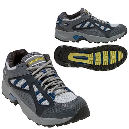
I walked into the Nantahala Outdoor Center’s (NOC) Outfitter on March 16th just after closing time.  My 2007 Montrail Hardrocks were falling apart after a mere 70-miles of hiking on the Appalachian Trail, and I needed another pair of shoes to continue hiking north.  The salesman, a previous Appalachian thru-hiker named Alpine, told me that he’d take care of me.  Thank God.

My hiking partner, Found (PCT ‘06, CDT ‘10) had a pair of green La Sportiva Wildcat mountain running shoes, which he highly recommended, saying that they are now the new standard for long-distance backpacking.  I noticed that Alpine also had a yellow pair.  The gear shop sold a red-colored pair of Wildcats for $99, so I asked to try them on.
  
I tried on my usual size 9, which Alpine thought was a half size too small for my foot - I agreed.  Then I tried on a shoe a half size larger, which allowed for more room in the toe box. After ambling up and down a small, portable ramp, I found the right fit, and bought them.  I thanked Alpine for staying 15-minutes after closing time, and walked out with my new shoes.

The Wildcats were super comfortable.  Unlike the rigid Hardrocks, which have a rock plate in the sole, the Wildcat’s Frixion soles had give to them, and felt gummy.  My feet liked this feeling.

Out on the trail, the soles gripped the AT’s tread of angled rocks and wood steps.  I felt confident with each step, and rarely did I ever slip on these surfaces, even when it was wet outside.  Muddy conditions were the “achilles heel” of this shoe, as I slipped and slid on ascents and descents.  However, I  think mud on the AT would cause most trail running shoes to do the same thing.

650-Miles of Wear on these Shoes!
I also found the Wildcats to be very breathable.  For the uppers, the shoe uses a lightweight mesh and thin inner liner, and in wet conditions, the shoe drained well, and dried out quickly.  I hiked a 350-mile stretch through the driest parts of the Pacific Crest Trail, and my feet never felt stifled by heat in the Wildcats.  They were perfect for the PCT!

I liked the lace harness on the Wildcats.  The shoes I purchased were roomy for my feet, but I felt that my feet were locked down in place due to the lacing.  Finally, I don’t know what La Sportiva did with the laces, but they never came undone on me on the trail.

Mesh Tearing from Sole
Alpine told me that I’d get about 450-miles out of the Wildcats, and he was right.  After hiking from Walker Pass to Highway 58 on the PCT in California, I noticed that the mesh was tearing apart from the sole on the right foot.  Then after hiking another 50-miles into the Antelope Valley, the mesh and inner lining on the Wildcats continued to tear away.   However, the soles had so much life to them that I continued to hike in them anyway, and I added another 200-miles to Alpine’s 450-mile prediction.

I highly recommend La Sportiva’s Wildcats for long-distance backpacking, especially if one is going ultralight.  The soles are grippy and durable, the uppers are breathable, and the shoe is designed for the comfort of feet.  Even though they started to wear out after 450-miles, one can get extra miles out of them.  I believe in these shoes so much that I’ve already purchased another pair.  This time they are green!

Saturday, May 7, 2011

Fire on the PCT - Alcohol Stove Safety

I shot this video last Thanksgiving at the Mosley Manor up in Milwaukie, Oregon.  I focused on being careful with fire on the Pacific Crest Trail, especially in light of the fact that there have been three fires in the last five years started by hikers who mishandled their alcohol stoves.  I presented this video at the ADZPCTKO Video Shorts Festival.  So, this is for all you hikers out there who missed the Kickoff.  Enjoy!

Wednesday, May 4, 2011

ADZPCTKO Presentations Over the Years

I love the Kickoff.  For seven years I have been involved with it as the Presentation Coordinator, and this recent event was my last in that position.  Yep, it's time to move on, and let someone else take over the reins.  I believe that one way for organizations to experience healthy growth is that they experience change, and thus my stepping down.

As the Presentation Coordinator, I have introduced many presenters to hikers in the Lake Morena pavilion, and I thought I'd list my favorite presentations from over the years.  So here it goes.

Winston Vickers
  1. Mountain Lions and Their Safety - Usually when I announced the presentation, everyone asked, "What about my safety?"  Wilderness veterinarian Winston Vickers has traveled to the Kickoff from UC-Davis three times to talk to hikers about mountain lions and the habitat that we hikers enter every time we explore the wilderness.  The reality is that humans continue to encroach on their habitat, and thus endanger these beautiful cats.  True, we also are risk entering their habitat, but attending Winston's presentation always helped me better understand mountain lions, and how to deal with them should I encounter one.  Finally, if there is one thing that was apparent from Winston's presentations, it is his passion.  He loves these animals, and he wants us hikers to have a better knowledge and appreciations for them.  I hope Winston comes back in the future.
  2. Paul Hacker and Greg Hummel
  3. Geology of the PCT - Greg "Strider" Hummel and Paul "Nohawk" Hacker both hiked the PCT in 1977, and are professional Geologists.  Their presentation on geology always fascinated me, so I attended everyone that they did just to see if I could scrape another nugget of information on the subject.  The Pacific Crest Trail runs across and along some of the world's most vibrant geological areas.  Consider that it crosses the San Andreas (and other faults!) several times, and it contours the Cascades' volcanos from northern California up to the Washington-Canadian border.  As Strider always says in his presentation, "Every rock is on a journey," and many of us hikers interact intimately with their journey as we traipse along the PCT.
  4. 1959 Thru-Ride
  5. Pioneering Women of the PCT - Barney "Scout" and Sandy "Frodo" Mann led this presentation in 2010, and it featured June Mulford, who along with her husband Don, thru-rode the PCT on horseback in 1959.  The presentation also had Teddy Boston, the first woman to thru-hike the PCT in 1976, and Carolyn Burkhart, who finished the same year as Teddy.  June Mulford's story was unearthed that year, so many of us there were eager to hear more about her ride on the trail.  Teddy, of course, is at the Kickoff every year, and is always entertaining.  Carolyn talked about her hike and how it helped her deal with personal struggles in her life.   It was a most memorable presentation. 
  6. Ken Murray
  7. Mountaineering Skills - On a heavy snow year, this is perhaps the most important presentation at the Kickoff.  Ken Murray has done this presentation every year that I have been involved with the Kickoff, and he balances the serious nature of hiking the Sierras along with making it an enjoyable experience.  Ken has also demonstrated how to ford river crossings, using an ice axe, and how to make a self arrest - all in the rugged conditions of the pavilion!  Ned Tibbits of Mountain Education has also helped Ken over the years, lending his rich mountaineering experience to the discussion.  
  8. Class of 2004 Photo Presentation - This is the class video that started a tradition that has endured to this day (Class of 2009 is the only one that has not been shown).  In 2005, Weathercarrot put together a photo presentation that set the bar high, and is now the standard by which all photo presentations are judged.  Panning in on dramatic images while mystical, ethereal music played in the background, he created the genre of video pleasure for eyes longing or eager to hike the Pacific Crest Trail. Thank you Weathercarrot!
Those are my favorite presentations at the Kickoff from over the years.  I am sure that the Kickoff will continue to flourish by bringing in knowledgable, talented, and entertaining speakers for years to come.  In the future, I look forward to enjoying those presentations as a participant, and not as a coordinator.

Saturday, April 23, 2011

Big Bear Lake for Easter Sunday

I pulled off the trail today to go to worship on Easter Sunday.  I have extra time on my hands, so I thought the opportunity could not be passed.

Spring continues to erupt throughout southern California, and a friend of mine reminded me of the significance of this time through the words of Martin Luther who said: "Our Lord has written the promise of resurrection, not in books alone, but in every leaf of spring time."  Of course the resurrection of Christ is central in the promise, but it is the 'ordinary' things in life that remind me of that great gift.  Yes, even the small, but colorful phlox ring out resurrection, even in a seemingly barren, desert landscape.

I am staying at the Big Bear Hostel here in Big Bear Lake, California.  I have the whole place to myself!  A hiker named Ari was here earlier today, but he left the trail to go to Los Angeles, and eventually to the Grand Canyon.  He said he could not handle the southern California desert sections, and was tired of the exposed sections of the trail.  I was puzzled to understand why he was leaving the trail, as I am really enjoying the desert environs.

I head out tomorrow after Sunday services.  I only have another 56-miles to hike by Wednesday morning, so I still have time to kill.  Therefore, I purchased a pair of hand loppers, and I will do some maintenance on the trail as I hike.  I thought I might as well take care of some of those stupid branches that cause us hikers to stumble or get caught in our eyelids.

Happy Easter everyone!

Thursday, March 31, 2011

Out of the Rain! Into Uncle Johnny's Hostel!

Found Hiking in Mist
As I write this post, it is raining cats and dogs outside. Right now, the southeast is just a big wet, muddy mess. The skies have been gray for 5 out of the last 6 days, and everything is just plain damp. This the the cold, wet AT that I signed up for!

When I started out on this hike, I was stunned by the nice, sun-filled skies. Temperatures were in the 60's and 70's, and I remember thinking to myself, hmmmmmm... it seems like the weather should be really crappy at this time of year. Well, it's now really, really crappy.

On top of Big Firescald Knob
Nonetheless, I had one really nice day between Hot Springs and Erwin, and I took advantage of it - I took a lot of pictures, and hiked a 20-mile day.  In spite of shifting rocks under foot, Big Firescald Knob had great views of the low country (and perhaps Knoxville) to the east and the Blue Ridge to the west.  It was an awesome day to be outside!

I have been hiking with Found (PCT 2006, CDT 2010) since Georgia, and I really enjoy his company.  What's interesting about our hiking relationship is that we are both interviewing for the same job with the Pacific Crest Trail Association.  How crazy is that?  One thing that I have discovered on these long distance trails is that it is a small world.  I have run into many hikers that I know (or hikers that I've heard of) on the trail over the years, so may be it's not so surprising.  While we may be competitors for the same job, we are companions out here on the trail.  I like that.
There was no view down to the Nolichucky River

I have only 50-miles to go before I am finished with this odyssey on the trail.  This next section of trail includes Big Hump and Little Hump, and Roan Mountain, which I remember being very scenic.  However, it looks like the weather will continue to rain over the next few days, so I am not guaranteed any sweeping views.  I will be getting off at Elk Park on Sunday, where I will meet up with my friend and 2009 CDT hiking companion, Patch.  I look forward to our meeting.

I am happy to be out on the trail, and I will check back in soon!

Sunday, March 27, 2011

Found's All You Can Eat Supper in Hiawassee, Goergia

Found and I stopped at Daniel's in Hiawssee, Georgia for supper.  It was an all you can eat supper, and we loaded up on the food.  Below is a little video of Found talking about his delight over the food.  Enjoy!

Tuesday, March 15, 2011

Rest in Hiawassee, GA

I am in Hiawassee, Georgia for a short break.  I stayed at the Blueberry Patch Hostel, which is 7.4-miles outside of town, and I definitely recommend staying there.  I get back on the trail later this afternoon, and then I will huff it to Fontana Dam, where I will be arriving on the 20th of this month.  I am really enjoying my AT experience again, and after eleven years off this trail, I have to say that there's not much of it I recognize!  So, in some ways, I feel like I never hiked this trail before.  More to come later.

Wednesday, February 16, 2011

Getting to the Appalachian Trail's Southern Terminus

Freefall at Springer Mountain, GA
I am making plans for the Appalachian Trail... finally. One thing is certain: I will be meeting up with Squatch up at Fontana Dam, NC around March 20th. However, getting to the Appalachian Trail's southern terminus (Springer Mountain) is still up in the air.

I did a Google search "shuttle to Springer Mountain, Appalachian Trail," and I turned up a wealth of information. Whiteblaze.net had some great suggestions.

Hiker Hostel, which is operated by Josh and Leigh Saint (770) 312-7342 looks to be the top choice. They offer a Thruhiker Special, which includes a pickup at the North Springs MARTA station, one night's stay, breakfast, 8 oz. of denatured alcohol, and a shuttle to Amicalola Falls State park. As of 2010, they charged $75 for the service, which seems very reasonable. I first read about them in an A.T. Journey's Magazine, and have been eager to check out their place. I also know that Josh and Leigh hiked the AT in 2000, so I guess I am biased to choose them. I signed up for a reservation online, and I look forward to hearing back from them. Hopefully they can swing the ride.

There's also a guy named Survivor Dave, (678) 469-0978 who also provides a shuttle from the North Springs MARTA station. The good news is that it looks like he keeps things simple: he takes one to the trailhead. The bad news is that he does not post a price. That actually deters me from choosing him. Second, I think it would be easier if there was a way to sign up for a reservation online instead of having to make a call. Not that I am averse to the phone. It's actually a west coast-east coast thing. As I research this at 8pm on the west coast, I am not apt to make the call at 11pm EST, and I am not going to remember to do it the following day. Nonetheless, he seems to run a good barebones service.

The Appalachian Trail Conservancy also provides a shuttle list, which includes others like Appalachian Adam and North Georgia Outfitters. Based on what I've seen online, I imagine anyone operating on their own schedule or with a myriad of needs can score a ride to Springer Mountain... I think I did (keeping fingers crossed)!

Monday, January 31, 2011

Urban Backpacking Trip to Hawk Camp

It's nice to have a car to go places for hiking and backpacking.  Ever since I got rid of my truck four years ago, I am not traveling as much to backpack those special destinations.  I now rely on friends to drive, public transportation, and my own two feet (yes, my own two feet!) to get around.
Sunset Picture of the Marin Headlands from Bobcat Trail

One of the joys I have discovered about being in San Francisco is that one can simply walk out the front door, and go on an overnight backpacking trip without the car.  Recently, I took a trip to Hawk Camp, which is located in the Golden Gate National Recreation Area.  The beauty of walking from the front door to the campsite is that the city itself becomes the hiking landscape.  Who says that mountains, trees, and rivers have to be the dominant features?  Hiking through the city is seeing the culture at work, the citizenry at play, and becoming more familiar with the urban geography and its unique features.

I hope the video I made captures some of the nuances of urban distance hiking, and the reality that our wild spaces are closer than we think.  Bear in mind here that those coyote yelps and owl hoots are just a few miles from San Francisco!  This is cool.

Saturday, August 7, 2010

Trail Maintenance: Report from the PCT - Part II

Freefall maintaining trail in Section O
The “O” in Section O means “OPEN!” After working two more hitches with members of the Northwest Service Academy on a three mile section of the Pacific Crest Trail from Peavine Creek to Red Mountain, and after hiking from Interstate 5 (Castella) back to Burney Falls State Park with a pair of hand clippers, I can with certainty say that Section O has never been in better shape - seriously.  That said, there are still brushy sections on the trail (Red Mountain to the PCT crossing at Grizzly Peak Road), and blowdowns between Mushroom Rock and Alder Creek Trail.  However, one Forest Service employee mentioned that he would be clearing the rest of the blowdowns soon, so there’s reason to be ever more optimistic on trail conditions through the section.

My volunteer service on the PCT is over for the meantime, but I sure wish that I could stay out here.  Seriously, I have thoroughly enjoyed sleeping out in a tent every night, getting my hands (and the rest of me!) dirty every day, hanging out and eating supper with the trail crew in the evenings, and hiking the trail in my off time.  I also got to make a big contribution to a trail that I so dearly love and enjoy, and I leave here knowing that users of the PCT will have a more enjoyable experience.

As I mentioned earlier, I got to hike Section O during one of my breaks, and the hike was so different than my 2003 thru-hike experience.  In 2003, I was suffering from an in-grown toenail, the heat was terrible, and the “O” in Section O stood for “Overgrown.” I remember manzanita, deer brush, vine maple, and tree branches growing in either side of the trail, and interlaced, which made the hiking a frustrating adventure.  Now, the corridor through Section O is very agreeable.

Trail Maintainer John Lyons
Another huge reason why the trail is in good shape is due to the Lyons' Pride, a trail crew headed up by John Lyons, who is also a backcountry horseman.  He has led a crew in May, June, and July, clearing brush and cutting trail near Ah-Di-Na Campground, Centipede Gulch to Butcherknife Creek, and from Deer Creek to Grizzly Peak.

When I ran into his crew, there were about 15-volunteers there, and among those volunteers was Warner Springs Monty. Monty was hiking the trail, but got off because his foot was giving him problems.  Instead of heading back home, he decided to help the Lyon’s Pride with cooking duties, since he is after all the stellar head chef for ADZPCTKO.

Monty was sure surprised to see me hike into the basecamp.  He introduced me to everyone who was doing trail crew, and I was kindly offered a soda to drink.  I introduced myself as a trail maintainer to the crew, and I told them about the section that I was maintaining.  I was offered supper, and I enjoyed some incredible barbeque chicken, salad, macaroni salad, and potatoes.  I rested at that campsite for about two hours, said my goodbyes, and I moved on to the summit of Grizzly Peak.

Vandalized fire tower on top of Grizzly Peak
One of my memorable experiences from my 2003 hike was camping out on top of Grizzly Peak, so I went for a repeat performance.  Again, I had wonderful sweeping views of Section O as I viewed Mushroom Rock to the east-northeast, Bald Mountain and Red Mountain to the East, 14,000-foot Mount Shasta to the northwest, and Castle Crags to the West.  The view was breathtaking.

One disappointment I experienced was the seeing the vandalism of Grizzly Peak fire tower, which was built in 1953.  In 2003, the windows were still in place, but now the glass is broken and scattered all over the top.  The bedspring that was in the tower in 2003, now sits near a newer, but ugly solar-powered weather station.  The peak is a mess, and I hope someone from the Forest Service or a volunteer group can get up there and clean it up.  Nonetheless, I found a spot for camping, and I enjoyed another stunning, memorable sunset and sunrise on the peak.

Chris Pyper of the Northwest Service Academy
There's a ton of work to do out on the trail, and each year, following winter's storms, the trail is littered with blow downs, the tread is eroded, or the brush creeps in yet another foot.  It's a never ending process.  Props to all those trail maintainers out there who give their time and talents to keep the PCT open for hikers and equestrians.  It's awesome!  Finally, I want to give a shout out to Northwest Service Academy's PCT II crew: Kate, Vyper, Shaughn, Sam, Max, and Libby.  Thank you for a memorable July 2010, and thanks for choosing to work on the PCT. Also, thanks to the PCTA's staff (Technical Advisor, Greg Baxter; Regional Representative, Ian Nelson; and Assistant Regional Representative, Val Sokolowski) for your guidance with all trail projects.  You are making a difference!

Wednesday, July 14, 2010

Trail Maintenance: Report from the PCT - Part I

Tamping dirt on rock water bar
Damn it's hot up here in Northern California.  For the last six days, I have worked with volunteers from the Northwest Service Academy's PCT II crew to clear three miles of trail from Peavine Creek to Red Mountain in the infamous Section O, and let me tell you, IT IS HOT! Every day temperatures surge into the mid 90's, and from what I've seen in the weather reports, it is supposed to get warmer.  Ugh.

Nonetheless, I am having a great time doing the much needed work on the trail.  I get to work with seven twenty-somethings, who are all keeping me on my toes, but I am keeping up with them.  I get to live in my tent at Headwaters Camp in McArthur-Burney Falls State Park.  I get to work and sweat every day.  I get to do a lot of reading - something I don't do enough of back in San Francisco! Finally, I get to experience the whole trail crew culture, which has intrigued me ever since I ran into trail crews back on the Appalachian Trail.

Northwest Service Academy PCT II and Freefall
The first two days of our hitch (that's what trail maintainers call their trail maintaining sessions) I helped install a rock water bar, which helps divert water off the trail and prevent erosion, and I assisted with doing some rock work to help repair/rebuild tread.  Kate and Vyper, the two leaders on this trail crew, told me that the first mile following Peavine Creek needs this tread work, because the tread had eroded into a U-shape.  They told me that the main culprit of this erosion are cattle, which freely graze in the mountains.

I did brushwork on the last four days of the hitch.  I ran a Stihl four stroke brush cutter, which has this awesome three-pronged blade on it, for two days, and on the other two days, I lopped and swamped. Swamping means that I picked up brush that was cut by the cutter, gathered it into stacks, and dumped it as far off the trail as I could.  If I wasn't swamping or lopping branches, then I was removing staubs, which are the those small stumps from bushes that are left over after clearing with a brush cutter. Many of the staubs are from vine maples, which seem to grow crazily on the PCT in Northern California.  The work is tedious, time consuming, and when done during the heat of the day, kind of gnarly.

Morning view of Mount Shasta from the Hat Creek Rim
I am currently staying at the home of Georgi (Firefly) and Dennis (Fire Walker) Heitman in the Hat Creek Resort area near Old Station.  I have never been here before, and now I can understand why hikers really enjoy coming here to the Heitman's.  There's a lot of room to spread out here, and Firefly does a great job of making hiker's feel welcomed.  Her hospitality has been much appreciated, especially after hiking 46-miles from Burney Falls and over the blistering hot Hat Creek Rim to get here.  I got to see Weather Carrot and Squatch while I've been here, and tonight I get to visit with Brenda Murray from the PCTA, and I looking forward to telling her about my latest adventure here.

I have two more hitches out here, each of which will be four days long.  After the next hitch, I plan to hike all of Section O to Dunsmuir, and then hitch (another use of the word!) a ride back for the final hitch (original use for the word).  After that, I will come back here to the Heitman's on the 27th, and from here I will hike to Belden to complete my hike of Section N. What a way to spend a July!  I only hope I don't melt by the time I finish my work and hiking.  Let's hope for cooler weather.