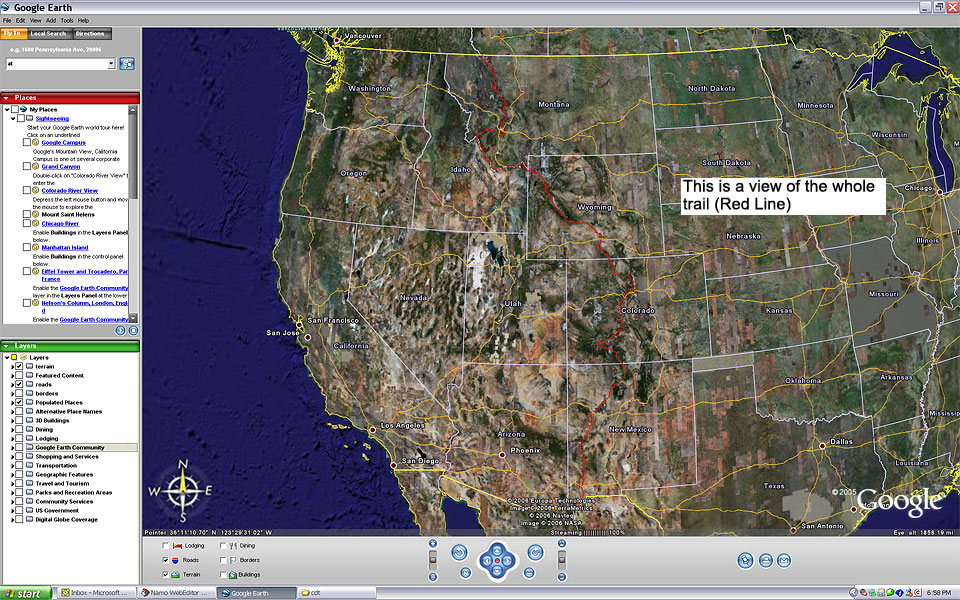
A few months ago, I read about Sage Clegg through a Google Alert. Sage completed her hike on the Continental Divide Trail on August 31st, and two weeks later, she set out to hike the Appalachian Trail, finishing on Christmas Eve. For those of you who don’t know, Sage is the first woman to complete the Triple Crown in less than 18-months. Her hiking credentials are off the charts, as her first thru-hike was a rare southbound trek on Pacific Crest Trail - that’s rad! She also completed here CDT-AT hike in just over seven months. Sage is a machine.
The following is a virtual question and answer session with Sage. Thanks to Sage for allowing all of us to learn what makes her tick, her highs and lows, and how she got that name ‘Sage.’ Enjoy!
Where do you live, and what do you do for a living?
Northern California is my home. I grew up in a small town in Mendocino county, went to college in Santa Cruz, and am currently attempting to move to Tahoe to learn to ski. I work as an instructor for Outward Bound (but not much in the past 2-years) and as a wildlife biologist in the Mojave desert.
Tell me about your gear. What was you favorite?
This year I used an
Osprey Exos 34. To date, it is the most comfortable pack I have used because of the ventilation system, but I went through 3 packs in the 4700-mile season - Osprey is working on the problem. Last year I used their Tallon 33, and I loved it, except that it wore out 5 shirts, not to mention some of the skin on my back - that is not an issue with the exos - I used the same shirt for 4600-miles!
I used my MontBell Super Stretch
30 degree bag for the entirety of my Triple Crown. I love this sleeping bag amp; can't believe it worked so well even in the uber cold of the AT. I also used a silk liner and a MontBell UL
sleeping bag cover. I carried 2-puffy jackets and used them as blankets inside the bag each night. In Colorado I was worried about being cold and carried 3-puffies, but that was a bit overkill.
My tarp is a little 8oz thing I bought off a friend. I have no idea who made it, but it was perfect for me.
I am sponsored by
OBOZ shoes based in Montana. I used a pair of their shoes for 900 miles on the PCT, and this summer tried a variety of their shoes, all of which are awesome. I started out with the
Hardscrabble, moved to the
Contour, then the
Sawtooth, and found the
Dash before I went to the AT. When the snow storms hit and my toes started to freeze in the runners I had a pair of the Galatin's shipped out and I LOVE them. I always think I should be stoked on runners, but then when I get into a light hiker my feet are usually happier.
I use Superfeet insoles, and for much of the CDT I carried
Crocs to give my feet a break on road walks. A friend told me he made some Croc insoles with a belt sander, so I convinced a guy at a ski shop to help me make a pair. They were awesome with the Sawtooths, but wouldn't fit in the Contours, so they made their way to the bounce bucket.
I am attached to everything in my pack, but my favorite thing is my mp3 player. I really enjoyed the company of music. I had some rules about when and how I listened to it, but I would have music in my ear (I have A headphone rather than two so I can hear my surroundings) about 8-hours a day.
How did you get the trail name “Sage”? That is a trail name, eh?
Nope. I was born and my parents decided to call me Sage. Little did they know they dubbed me with a trail name from day one. I am pretty sure I would have acquired a trail name if I hiked a trail around other people, but since I am always going the wrong way nothing has ever had time to stick.
How did you first get interested in thru-hiking? Any inspirations or motivating factors?
When I was 14, I went on an Outward Bound course. On day 3 I decided to become an instructor some day, and that is when the PCT entered my consciousness. I always assumed the PCT was an unattainable goal. Then, in the fall of 2008 I found myself ending my 6-year instructing career with Outward Bound, because they were shutting down my bases (Montana and Texas). I was devastated, but I decided to double time on my other job, Tortoise biology in the Mojave.
I arrived in the desert for a contract and two days into the season the contract got canceled. I was down two jobs in the span of two months. I called my friend Pepper and he said whenever he is down on his luck and feeling poor he goes for a hike. I asked where I could hike in November and he mentioned the
Grand Enchantment Trail (GET). Two weeks later on November 14, 2008 I set out from Albuquerque on my first thru-hike on a deserted and freezing GET. My 29th birthday was on the 18th, and I sat down eating a birthday brownie a friend had given me, and I decided I would hike 3000-miles before I turned 30. 27-days later I reached the Arizona-New Mexico border completely in love with thru-hiking, 450-miles closer to my goal of 3000.
According to reports, you are the first woman to thru-hike the Appalachian, Pacific Crest, and Continental Divide trails in an 18-month period. Was that your intention when you took your first steps on the PCT? If not, what led you to go for it? How does it make you feel to be the first woman to hike all three trails in 18-months?
When I started my southbound PCT hike in 2009, I wasn't sure if I could even get through Washington. Then I made it to Oregon, and took a 20-day break to go work a course in the Sierras. When I returned, I wasn't sure if I would make it to California. Then California hit, and I was running to get through the Sierras before winter shut me out. Even when I reached Campo I still didn't believe I could do it, but I had.
I went out to try and finish the GET a few days after I finished the PCT. Two days into that hike it was my 30th birthday. I woke up early, shooting for a 30 on my 30th, but when I stood up from lunch I could hardly walk. I had strained both my knees on the wonderfully steep and uneven terrain of the GET - I guess I had gotten soft on the PCT trail tread! I walked the 80-miles to Safford Arizona, going backwards down hills and trying to convince myself to go home and heal up, but letting go of a dream has never been my strong suit. I begrudgingly left the GET for home with 218-miles left to go for a winter of doctor visits and physical therapy routines.
When I started the CDT in May, I was uncertain if I could even make it through New Mexico, much less to Canada. The miles started passing, and I got into the groove.
In Pie Town, New Mexico I was reading the register and saw Li Brannfors entry from 2007. He had signed with this awesome looking CDT/AT logo and from that moment on I couldn't shake the idea of hiking them both in a season. I tried to talk myself out of it for a lot of reasons. Would I be able to handle 8 months of hiking? Would I get out to the AT and have a GET knee injury again? Would it even be fun anymore? Would I ruin my passion for hiking? But the thought of hiking the AT southbound in the fall meant fall colors, no bugs, fewer crowds... and I just wanted to try it. The idea was something logic and reason could not sway. So I told myself that if I finished the CDT before September 1st I should go out to Maine. Travel from Montana to Baxter State Park fell into place so easily, and then suddenly I was hiking on the AT!

I didn't realize I would be completing my Triple Crown in 18 months until I was wandering through Vermont one afternoon. Once I realized that it definitely had an effect on me. Suddenly I had a time goal and my ego was attached to the hike for the first time. I couldn't believe that I might be the first woman to have done this. There are so many other amazing female hikers and athletes out there, and I am sure my “record” will be surpassed as soon as other women realize that it can and should be done. Part of me wants to try for a calender year, but right now I don't really want to cover all that ground again.
I hope my 18-month triple crown will inspire other women to get out and hike. Solo or not, thru or section, heavy or light, it doesn't matter. I think the world will be a better place if more people know themselves and true wildness better. Getting out onto a trail is one of the simplest paths to self discovery. John Muir hit it on the head: Going out is really going in. I hope I have been able to open the door to the interior for a few people other than myself. Hiking feels so selfish sometimes, but I want my adventures to be shared, so I am not the only one who gets the glow.
What was it like for you to go from thru-hiking the CDT, a largely non-blazed, navigational challenge, to a white blaze highway like the Appalachian Trail?
My first lesson was that the AT was no cakewalk. I couldn't believe that THOUSANDS of people had scrambled over those rocks and roots! The second lesson was that I realized I hike to be free. The white blazes were always telling me where to go. I felt stifled on the AT and had to work really hard to adjust my perspective so I could enjoy my time out there. For a more thorough explanation check out my last postholer
entry.
Were there any challenges to going straight from the CDT to the AT? How were you feeling physically, mentally, and emotionally at the midway point and at Springer Mountain on the Appalachian Trail?
Katadhin kicked my ass. I took a zero on day two to recover and tried not to freak out too much. I was really worried I would have a GET repeat. By the end of the 100-mile wilderness my knees still hurt, but they were walkable, and I knew that as long as I didn't go too hard I could stay on the trail. I almost quit at the end of Maine because I was hating the trail and I had a good work offer back in California. I couldn't convince myself to leave though. I kept thinking that if I came off I would have to hike ME again and I don't ever want to deal with those bog bridges and SEGAL (Sensless Elevation Gain And Loss) trail again.
At Harper's Ferry I got food poisoning, but the weather was really good and my spirits were high despite having to dig holes every couple of hours.
December was filled with snow and ice storms and the only reason I didn't come off was because I was so close to the end. The last 24-days of my AT hike were some of the hardest days of my life. My motivation had tanked and things that had once been fun were miserable, it was too cold to crave ice cream, I was worried about finishing on time, getting out of my sleeping bag was almost impossible (one very cold morning it took me 4-hours!). If I had been fresh four blizzards in a row would have still been hard, but it is amazing how much attitude controls enjoyment. I had run out of tolerance and patience for challenge and it took everything I had to plow through the snow.
Of three trails, what was your favorite trail? Why? If you could hike one over again, which one would you do first?
The CDT is so wild. I loved it. The PCT is stunning and allowed me to fly along at a pace that doesn't seem possible. I don't think I will re-hike either in their entirety again, but they will both be incorporated into routes I am making.
Describe for me your favorite moments on the AT, PCT, and CDT? What were your most miserable moments?
AT -
High: Cutting down a christmas tree with the family at Standing Bear Farm during a bilzzard induced zero day.
Low: Bailing to a low route in the Smokies after deciding I was too much of a wimp to hike over drifts of snow alone for 6 days.
CDT -
High: So many, it's hard to choose. Seeing a pack of 5-wolves on a hill top at sunset near Lima. Seeing and hearing my first Willow Fly Catcher in the headwaters of the Missouri River.
Low: Sleeping by a broken bridge near twin lakes, CO after a 15-hour day in which I hadn't even gone 30-miles (I was pissed) and having nightmares all night about the bridge breaking. In the morning I crept over the broken bridge, went into town, and re-united with my friend Ahab, from whom I had been separated the day before. He informed me that there was another un-broken bridge about 3-minutes upstream from where I had crossed. I couldn't believe I had been so unaware!
PCT -
High... Yep. That is how I felt on the PCT. My night at
Drakesbad Guest Ranch was AWESOME! They fed me the most amazing steak I have ever eaten along with endless cups of hot chocolate, and then I got to have the whole hot spring pool to myself and sleeped on a comfy couch!
Low: Getting snowed out of the sierras the first time. The storm hit just after I crossed Donahue pass and I came out at Devil's Postpile. I was pretty sure I would have to miss the 250-miles I had been most looking forward to, and that was pretty devastating. A friend of mine helped me figure out a way to get back into the mountains with only missing about 10 miles of trail. A weather window opened, and I made it over Forester Pass before I got snowed out for a second time. Creativity, flexibility, and the help of friends let me stay on the trail and have a successful hike, but I have never felt so sad and disappointed as I did on October 4, 2009 when I hitched into Bishop.
What are your plans for the future? Another hike?
This off season I hope to learn how to communicate more effectively by finding my inner computer geek side. I want to be able to get the word out a bit more about how cool hiking is and advertise the Emily Sandall Foundation. As I hike, I am trying to raise funds for the Emily Sandall Foundation, a non-profit that creates opportunity for true childhoods all over the world. That means they give scholarships for backpacking trips here in the states and provide mini-grants and other financial support to people doing grassroots projects that work against child labor. Check out
emilysandall.org for more info. This foundation was created in honor of my good friend Emu who passed away in a hiking accident on Half Dome 4-years ago. She would have loved thru-hiking and I think about her often when I am on the trail, so my footsteps are for her. Figuring out how to ask for money and to communicate to a larger audience is something I struggle with - I don't want to feel like I am bragging or begging. I do believe whole-heartedly in the organization I hike for, and I also know that me telling other people about my adventures will inspire them to get out and challenge themselves too. I just have to buck up and learn to sit in front of a computer.
This summer I am hoping to put together a route that connects the Pacific Ocean in Mendocino to Death Valley. I'm calling it the Japhy Ryder Route and hope to start it this June.
If you could give one piece of advice to anyone wanting to do a long distance hike, what would you tell them?
You have to go to know. Get yourself out the door! (It is worth quitting your job for, the universe will provide, and money isn't everything. Just try it- life isn't a chess game, you can't plan it because plans fall through-- JUST LET YOURSELF GO HIKING!!).
How are you readjusting to life after the trail?
I just went to an acupuncturist and she said the symptoms I was describing are what people usually say when they go into the backcountry. I guess for me it is reversed because I am more comfortable out there than in cities.
My readjustment could be going worse, but it is pretty intense at the moment. My truck died while I was away, and since it was at my house I have had to scramble. I do have an amazing community here in central California to help me out. I have a great place to stay while I recollect the pieces, sort through 8-months of mail, buy a new truck, get my teeth filled (I ate too many jolly ranchers on the trail I guess..), and search for work. All my dreams of renting a place in Tahoe and skiing all winter have been put on hold, but surfing and spending way more money than I have isn't that bad either. I will start work sometime in March, so for now I have to provide myself structure. I think this is the hardest part. I have too much freedom at the moment, and my drive to do hard things is non-existent. I am a bit of a couch potato these days, and the efficiency standards I have held myself to for the past 8-months have no place in my current lifestyle.
Last winter I got pretty depressed and I hope to avoid that this year. I am trying to get into running shape and do yoga, but I am so used to having my exercise be a part of my daily life that carving out time for it is a challenge. I guess it is a challenge I will just have to rise to if I don't want to ferment in self pity this winter.
Another thing to help me avoid the post trail blues is the planning of the Japhy Ryder Route. Even though I don't need to use maps every day I still get to look at them, and it is quite therapeutic.